We guide rafting trips Glacier Park’s rivers, the North and Middle Forks of the Flathead River, Montana, USA! What’s the difference between the forks? What makes them extra special? Well, a lot, actually.
Although you can’t actually raft inside Glacier Park, you can float the southern and the western borders of the park, which are the North and Middle Forks of the Flathead River. Which we’ve been happily doing since the 1980s.
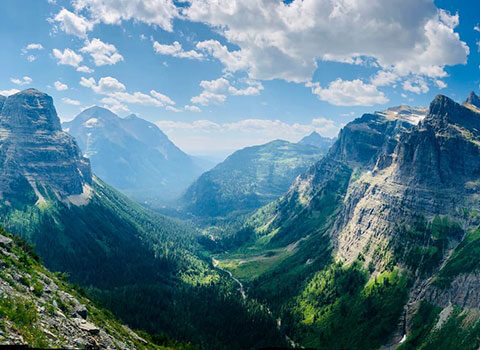
Glacier’s Rivers: The Middle Fork Flathead
The Middle Fork of the Flathead River was a major part of the inspiration for the Wild and Scenic Rivers Act, the strongest protection a river in the United States can have. The Middle Fork runs for approximately 92 miles and forms the southwestern boundary of Glacier National Park. It has both whitewater and flat water sections.
The Bob Marshall Wilderness Complex is home to the headwaters of this river. Once out of the wilderness area, the Middle Fork Flathead parallels US Highway 2 on the southern boundary of Glacier. This is where all of the commercial outfitters run their rafting trips, scenic and whitewater. Towns along the river include West Glacier, Nyack, Pinnacle and Essex. River access points are paved, and typically have outhouses available.
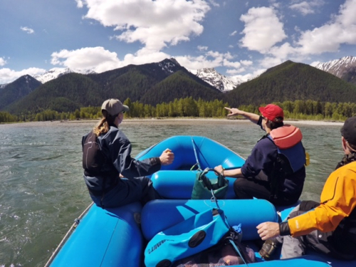
The Middle Fork eventually meets up with the North Fork at Glacier’s southernmost point. You’ll raft through this gorgeous confluence on a Scenic Float trip with us, and get an unusual perspective into the park from the water.
Next, the forks join the South Fork Flathead –which also begins in the Bob and empties out of the Hungry Horse Reservoir, south of the park. Together, the three forks form the main stem of the Flathead River, which flows into Flathead Lake.
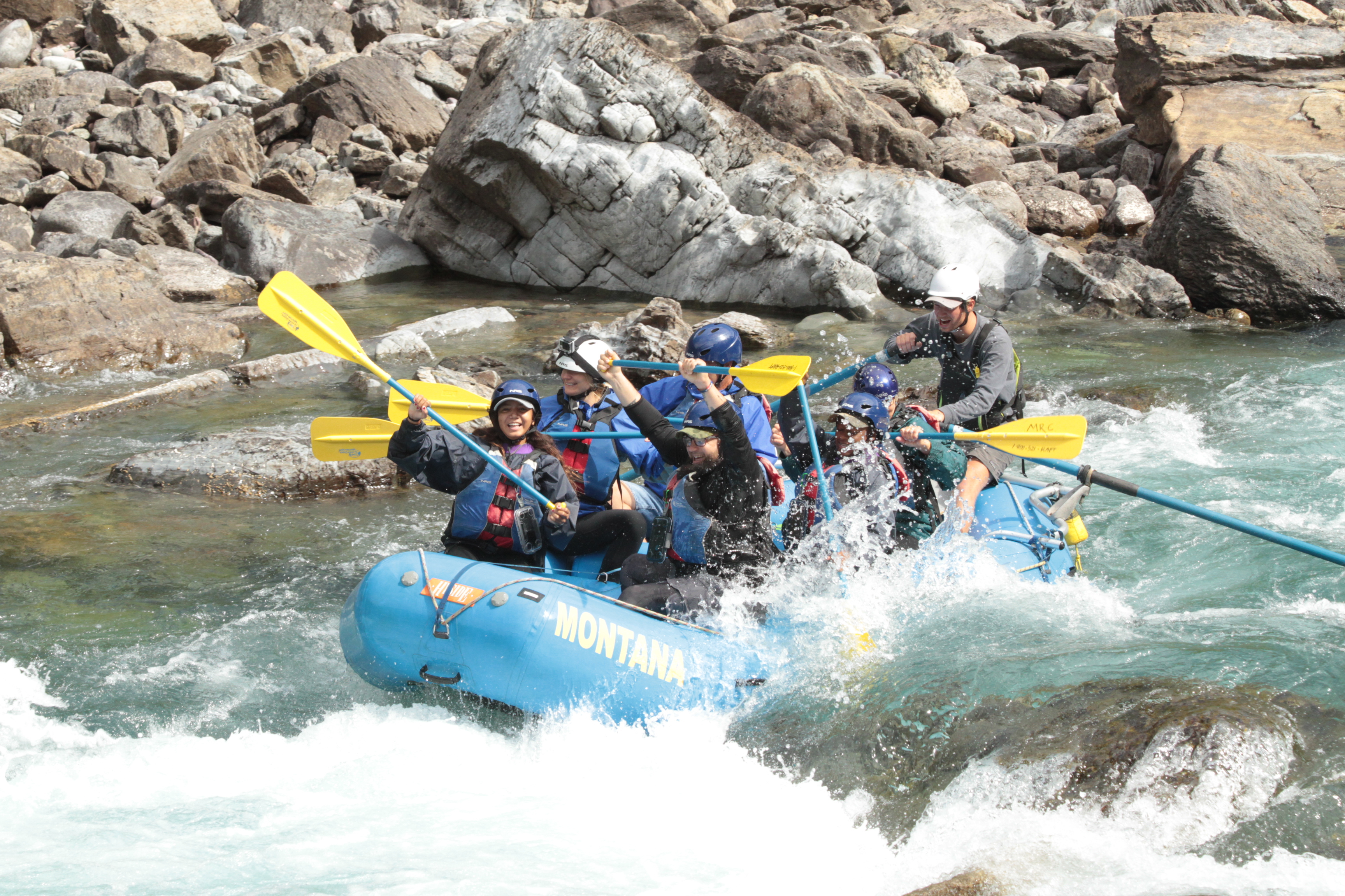
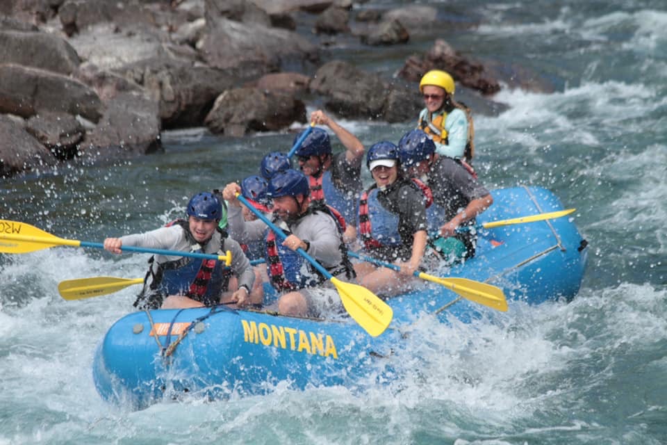
Having all the fun whitewater rafting Glacier National Park!
MIDDLE FORK FLATHEAD RIVER QUICK FACTS
Classification: I (scenic section), II – III (whitewater section)
Water Levels: USGS site can give you current levels.
Campgrounds on the river: Primitive and accessible primarily only by river. A mix of private property and Forest Service land is on the left side of the river and river right is Glacier National Park.
Fishing: Montana fishing license required.
Type of Fish: Rainbow, cutthroat, whitefish and bull trout (note that bull trout are a protected species – read Montana fishing regulations here).
Fees: Commercial rafting companies pay a Forest Service fee to help cover costs of put-in and take-out maintenance.
Restrooms: Outhouses are located at most boat launches.
Designations: National Wild and Scenic Rivers System.
If you are looking for a fun, splashy day on Glacier Park’s border rivers, the Middle Fork is for you!
Glacier’s Rivers: The North Fork Flathead River
The North Fork is the largest of the three tributaries of the Flathead. British Columbia, Canada, is the headwaters of this river, which flows south to form the northwestern boundary of Glacier National Park before joining the Middle and South Forks. The North Fork is wide and tends to braid, typically leading to lower water perfect for inflatable kayaks, canoes, and other small watercraft by August.
River launches are accessed via the outer North Fork road, which turns to dirt about 10 miles north of Columbia Falls. Polebridge is the only town along this stretch of river before it joins the main stem of Flathead River. Check out North Fork regulations and river map here.
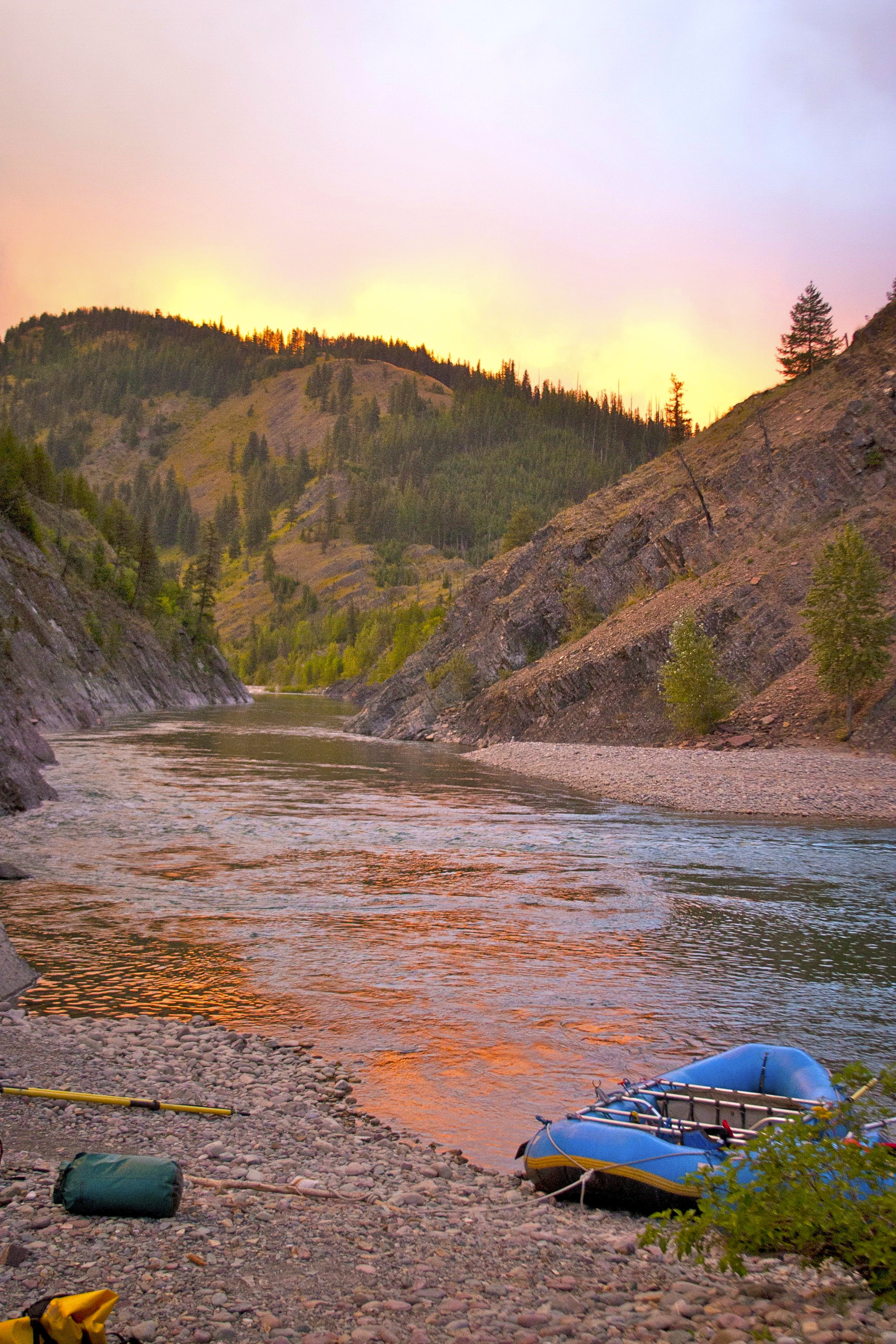
Tied off on the North Fork of the Flathead River, on Glacier National Park’s western border.
NORTH FORK FLATHEAD RIVER QUICK FACTS
Classification: I-II rapids (mostly a float for rafters)
Water Levels: USGS site can give you current levels.
Campgrounds: Primitive. Most sites can be reached by boat and car via the outer North Fork road. River left is Glacier National Park and river right is a mix of Forest Service and private property.
Fishing: Yes, very popular here. Montana fishing license required.
Type of Fish: Rainbow, cutthroat, whitefish and bull trout (note that bull trout are a protected species).
Fees: Commercial rafting companies pay a Forest Service fee to help cover costs of put-in and take-out maintenance.
Restrooms: Outhouses are located at several put-ins and take-outs.
Designations: National Wild and Scenic Rivers System.
If you are looking for a quiet, relaxing, remote destination this is the river for you!
Glacier Guides and Montana Raft Trips on Glacier’s Border Rivers
Middle Fork Flathead River Only
- Half Day Whitewater
- Half Day Whitewater with Dinner
- Full Day Whitewater with Lunch
- Half Day Scenic Float
- Half Day Thrillseeker
- Half Day Inflatable Kayak
- Full Day Inflatable Kayak
- Ride and Raft
- Backpack and Overnight Raft
- Walk and Whitewater
- Walk and Float
- Paddle and Pedal
On Both Forks of Glacier’s Rivers
- Half Day Fishing
- Full Day Fishing
- Private, Custom Overnight Rafting
- Private, Custom Rafting Experiences: Day Trips
Rafting Glacier’s rivers on your own? Great! Be sure to read river regulations and check out river maps here. See you out there!
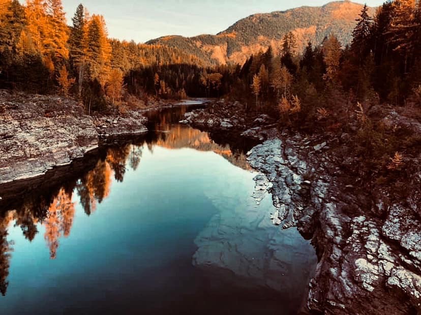
November views from the Belton Bridge over the Middle Fork Flathead. Caiti Woods photo.